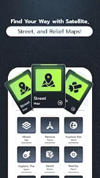
Comprehensive Mapping Tool for Travelers
Live Satellite View Map is an Android application designed for travel and navigation enthusiasts, offering a blend of mapping features and tools to enhance exploration. Users can access various map types, including satellite views for aerial exploration, classic 2D street maps for straightforward navigation, and terrain views that highlight elevation details. The app also includes a mixed map option that combines satellite imagery with street and place names, making it versatile for different navigation needs.
In addition to its mapping capabilities, Live Satellite View Map features a range of tools to enrich the user experience. Users can explore famous landmarks, discover new locations randomly, and even delve into maps of planets for a broader perspective. Additional functionalities include saving and sharing addresses, finding nearby essential services, and tracking movement with a speedometer and a classic compass for easy navigation.